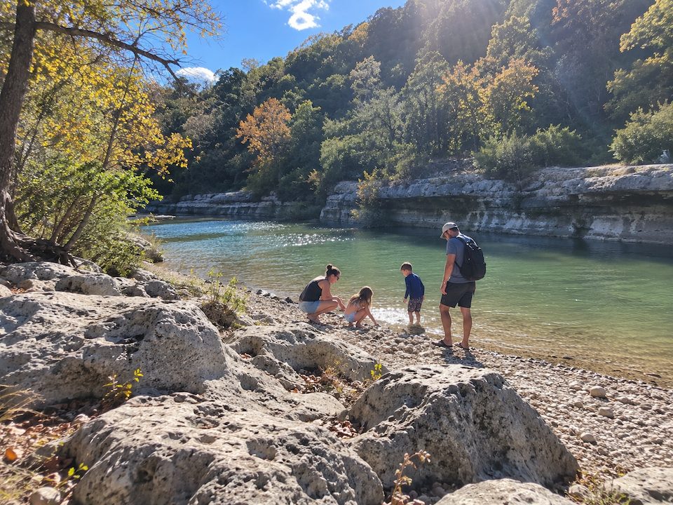
Two things can catch first-time visitors out. Someone parks at the wrong end of a creek corridor with more than 12 miles of trail and seven City-listed access points, or they hike in to a famous swimming hole and find dry, pale limestone where the photos showed green water. The pool that was full last month can be bare rock this week.
That makes two decisions more important than anything else about a trip to the Barton Creek Greenbelt: which access point you use, and what the creek is likely doing that day. This guide covers both, along with where to park and what it costs, how to check the water before you drive, and the rules that apply to your dog, your cooler, and your timing. Current conditions and notices live on the City of Austin’s Greenbelt page, which is worth a look before every visit.
Barton Creek Greenbelt at a Glance
Hours, fees, and conditions change. Confirm on the City of Austin site before visiting.
How the Greenbelt Is Laid Out
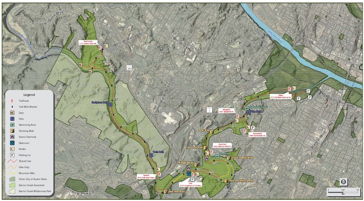
The City organizes the Greenbelt by mile marker. Mile 0 sits at Zilker Metropolitan Park, next to Barton Springs Pool, and the corridor runs upstream to mile 7.5 at Camp Craft Road. Barton Creek and the main trail follow the valley between those two points, and the other access points drop in from neighborhoods and highways along the way: Spyglass Drive, Homedale Drive, Barton Hills Drive, Loop 360 (South Capital of Texas Highway), and the MoPac Expressway service road.
You will see the length quoted as 7, 7.25, 7.6, 7.9, and even 12.68 miles depending on where you read. The City describes a main trail of about 7.5 miles and more than 12 miles to explore across the Greenbelt, so use its official trailhead map (PDF) to plan a specific route rather than treating either figure as one fixed end-to-end distance.
A practical plan is to walk one stretch from one access point and turn around, so your entry point decides the day.
Barton Creek Greenbelt Access Points Compared
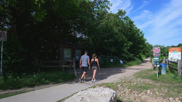
All seven trailheads below come from the City of Austin’s own listing, in the City’s mile order, with the City’s names and addresses.
*Parking terms are as listed by the City of Austin and can change. Confirm before visiting.
Lower Greenbelt: Zilker, Spyglass, Homedale and Gus Fruh (Miles 0 to 2)
The lower Greenbelt has the most entrances and the most residential parking.
- Zilker trailhead, 2212 William Barton Drive. The mile 0 entrance has a parking lot, a restroom near Zilker Hillside Theater, and the start of the Violet Crown Trail. Seasonal weekend and holiday parking charges apply here, covered in the parking section below.
- Spyglass, 1601 Spyglass Drive. Street parking only, with one composting restroom a short walk in from the trailhead.
- Barton Hills School Park, 2009 Homedale Drive. A free lot at the school park and no restrooms, so plan accordingly before you leave the car.
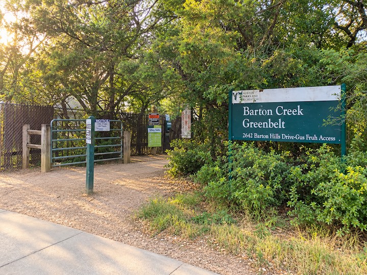
- Gus Fruh, 2632 Barton Hills Drive. Limited free street parking and no restrooms. This entrance shares its name with Gus Fruh, one of the best-known swimming spots on this stretch.
Campbell’s Hole and Gus Fruh are the two swimming spots most people associate with the lower Greenbelt. The City does not publish walking distances to either, so trace your route on the official map before you set out. Three of these four entrances sit on residential streets, which is why parking etiquette matters more here than anywhere else on the corridor.
Middle Greenbelt: Loop 360 and Twin Falls (Miles 2 to 4.5)
- 360 Trailhead, 3753 South Capital of Texas Highway (northbound). A dedicated free lot with composting restrooms right at the trailhead.
- Gaines Park/MoPac Trailhead, 3918 South MoPac Expressway southbound service road. Limited free street parking and no restrooms. This is the City-listed access to Twin Falls.
Sculpture Falls, the other well-known falls on the Greenbelt, is also reached from this middle part of the corridor. The City does not list a distance from any trailhead, so check the map for your route.
If you want a dedicated free lot and restrooms at the entrance, the 360 trailhead is a sensible choice. Space is never guaranteed, though. Homedale also has a free lot, but it opens onto the lower Greenbelt, so switching there changes your starting point and the distance to your intended destination.
Upper Greenbelt: Trail’s End and the Hill of Life (Miles 4.5 to 7.5)
- Trail’s End/Camp Craft Road Trailhead, 1712 Camp Craft Road. Paid street parking daily from 8 a.m. to 8 p.m., two composting restrooms a short walk in, and the City-listed access to the Hill of Life.
The Hill of Life is a steep, rocky climb, the kind where your footing matters more than your pace. The City publishes no parking rate for Camp Craft Road, so read the posted signage when you arrive.
Parking, Fees and Hours
Admission. The City lists no entry fee for the Greenbelt. What you pay for, if anything, is parking.
Zilker trailhead lot. The City’s Zilker Metropolitan Park page lists, as of October 2026, $3 per hour per vehicle on Saturdays, Sundays, and official holidays, from the first Saturday of Spring Break through Labor Day, paid at pay stations or through the Park ATX app, with all parking first-come, first-served. The Greenbelt page still shows an older flat fee, so confirm the lot, price, and posted terms on the City site and the on-site signs before you park.
Camp Craft Road. Paid street parking from 8 a.m. to 8 p.m. daily. Check the posted rate on arrival.
Everywhere else. The City lists a free lot at 360 and Homedale, free street parking at Gus Fruh and Gaines Park/MoPac, and street parking at Spyglass.
Hours. City parks are generally open 5 a.m. to 10 p.m. unless otherwise posted, and the City’s Greenbelt page states that all park facilities close at 10 p.m. under City ordinance. The City also notes the Greenbelt has little to no lighting.
A weekend or holiday arrival at Zilker during the paid season means paying by the hour. The free lots at 360 and Homedale avoid the fee but are first-come, first-served like everything else.
Parking in Neighborhoods Without Becoming a Problem
Spyglass, Gus Fruh and Camp Craft Road all rely on street parking in residential areas. A few habits keep that access workable:
- Leave driveways and mailboxes clear. Park fully clear of both, even for a short hike.
- Read the signs before you lock the car. Restrictions vary street by street.
- Keep it quiet coming back. Car doors and speakers carry at the end of a long day.
- Keep your trash in your car. Not on a resident’s curb or in their bins.
These are residents’ streets, and the Camp Craft trailhead stayed closed for several years at a neighborhood’s request after it was built. Access depends partly on goodwill.
Swimming Holes and Why the Water Comes and Goes
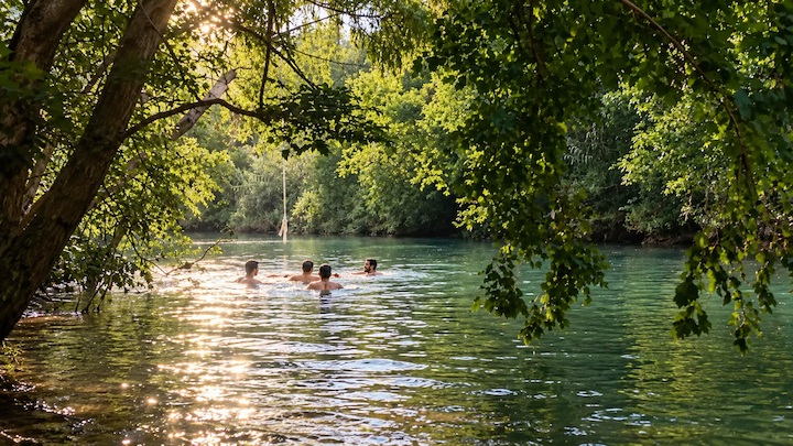
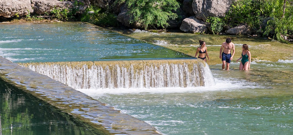
The Greenbelt’s water is unreliable for a structural reason. Barton Creek crosses the Edwards Aquifer recharge zone, where caves and openings in the Edwards limestone meet the land surface. According to City of Austin Watershed Protection material, some surface water enters fractures and openings in the limestone and moves into the aquifer that feeds Barton Springs. Recent rainfall and runoff drive creek flow, and losses to the aquifer can contribute to low or dry stretches when incoming flow is limited. The City notes the Barton Creek watershed holds about 60 springs and 20 caves.
That is why the same pool can be swimmable one month and dry rock the next.
Where People Swim on the Greenbelt
- Campbell’s Hole. A lower Greenbelt spot reached from the 0 to 2-mile band. Whether it holds swimmable water depends on how much has been coming down the creek recently.
- Gus Fruh. Shares its name with the Barton Hills Drive trailhead. Like every pool on the corridor, it can range from inviting to a shrinking puddle depending on recent rain.
- Twin Falls. The City lists Gaines Park/MoPac as the access point. The falls need flow to be falls, so a dry spell can turn them into a rock ledge.
- Sculpture Falls. Reached from the middle Greenbelt, though the City’s trailhead listing does not name it as the destination of any access point, so plan your route on the official map. Like Twin Falls, it depends on flow. The City has recorded a past harmful algae bloom below the falls when the creek dried into an isolated pool, so stay out of stagnant water here and check current City guidance before swimming.
These are natural creek pools with no lifeguards. They are not a managed swimming facility, and the City does not publish depth, temperature, or walking times for any of them. When the creek is low, Barton Springs Pool at Zilker, right next to the mile 0 trailhead, is the City-run alternative. Check that page for its current hours and fees.
Why Barton Creek Runs High, Low or Dry
The City says it directly: water levels on the Greenbelt vary with recent rainfall. Upstream rainfall can raise creek flow, but not every rain does. When little is coming in, losses to the aquifer over the recharge zone can leave stretches low or dry.
The City also cautions that water levels can rise quickly, even in dry conditions. Rain upstream can reach the corridor when the sky above you is clear. There is no reliable “full season” to plan around. Water follows recent rainfall and local conditions rather than the calendar.
How to Check the Water Before You Drive
Austin Parks and Recreation does not monitor the Barton Creek water level. The USGS and LCRA maintain gauges on Barton Creek, and those are the tools to use.
- USGS gauge “Barton Creek at Loop 360” (site 08155300). Open the USGS monitoring location page, choose discharge or gage height, check the observation time, and look at the recent trend rather than a single number.
- LCRA Hydromet. The LCRA Hydromet system carries Barton Creek data as well, useful as a second look.
The two measures mean different things:
- Discharge is flow, reported in cubic feet per second. It tells you how much water is moving past the gauge.
- Gage height is the height of the water surface above a reference point at the station. It is not swimming depth.
Know the limits before you trust a reading. The gauge describes the Loop 360 location, not every pool on the corridor. It does not test whether the water is safe. A zero-flow reading does not prove every pool is empty, and a healthy flow does not promise a particular hole is swimmable. No official reading marks “good swimming.” Combine the gauge with the weather forecast, any current City notices, and what you see when you arrive. That five-minute check is worth it whether you live ten minutes away or are driving in from the Hill Country for the day.
Water Quality After Rain and the Algae Warning
The City advises people and pets not to enter natural water if there has been rain in the past three days, or if the water is warm or stagnant or shows scum, film, or algae. After any contact, rinse your skin and your animal’s fur, and do not let a dog lick its fur before it has been rinsed.
Waiting three days is not a guarantee that swimming is safe. The higher-risk scenario is the shrinking pool: once a stretch stops flowing and the water sits warm and still, conditions change. That has happened here before. A harmful algae bloom once occurred in Barton Creek below Sculpture Falls during a summer when the creek dried into an isolated pool. Treat that as history, not as a current alert or an all-clear.
For current status, check the City’s Algae in Austin’s Waterways page before you go. None of this is a reason to skip the Greenbelt. It is a reason to look before you get in.
Hiking the Greenbelt: Picking a Stretch by Effort
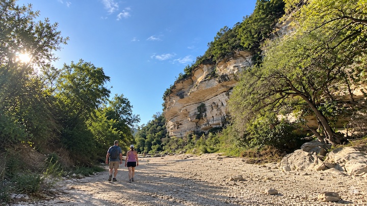
The City describes the Greenbelt as rugged, with limestone cliffs and trails that are rough and uneven. On the ground, that means rocky footing almost everywhere and creek crossings that are easy or tricky depending on the water level.
Pick your stretch by the day you want:
- Families and first-timers. A short out-and-back from a lower access point keeps the walk manageable and the car close.
- A dedicated lot with restrooms. Start a mid-corridor walk from the 360 trailhead.
- The Hill of Life. Start from Camp Craft Road on the upper Greenbelt and expect a steep, rocky climb.
Hikers wanting distance beyond the Greenbelt can pick up the Violet Crown Trail, which begins at the Zilker entrance. The City does not publish trail mileage between named spots, so the official map is your reference for route length.
Mountain Biking and Rock Climbing
Mountain biking. Bikes are allowed, and the City’s rules are clear: yield to pedestrians, ride single file, announce passes or use a bell, and obey posted speed limits. The City also states that road, cruiser, and commuter bikes are not recommended on this terrain. Bring a mountain bike or plan to walk.
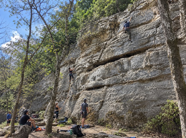
Rock climbing. The limestone cliffs along the creek have a long-established climbing culture. The City publishes no climbing guidance, so check posted signage at the trailhead and use established access trails to reach the walls. That keeps you consistent with the City’s stay-on-trail rule and protects the habitat along the creek.
Bringing a Dog to the Greenbelt
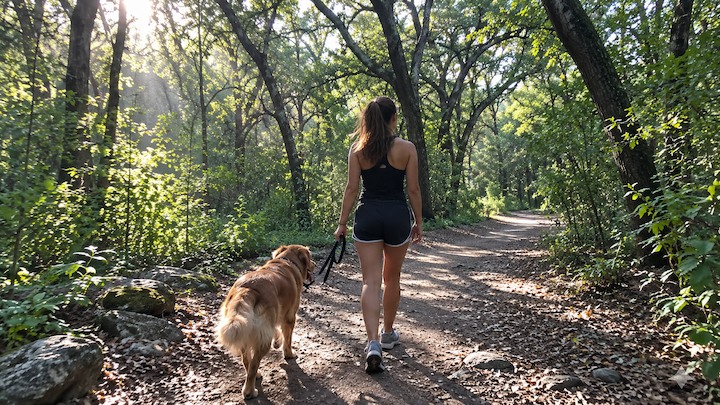
Dogs are welcome, under clear rules:
- Six-foot leash, maximum. Keep your dog close on the leash at all times.
- No off-leash areas here. City Code requires dogs on leash in public areas unless they are in a designated off-leash area, and the Greenbelt is not one. The City’s dog parks page lists where off-leash play is allowed.
- Pick up and carry out waste. The City notes that animal waste affects Austin’s water quality. Trash receptacles exist only at trailheads, so waste bags travel with you for the whole walk.
- Same water caution as for The City’s three-day rain guidance and algae precautions apply to dogs, including rinsing fur before your dog can lick it.
Bring drinking water for your dog. The City advises people and pets not to drink directly from natural water bodies or enter warm or stagnant water.
Rules That Shape a Visit
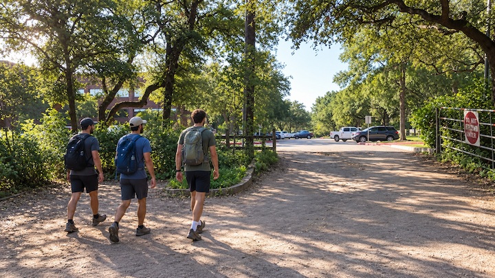
- Facilities close at 10 p.m. Plan your exit so you are back at the car before then.
- No alcohol. City Code 8-3-1 prohibits possessing or consuming alcohol in a public recreation area unless code provides otherwise. Leave it at home.
- No camping. Camping is not allowed on the Greenbelt under City camping guidance citing City Code 9-4-11.
- No glass, Styrofoam, smoking, or vaping. The City’s parks policy prohibits glass, Styrofoam and smoking in all City parks, and its park rules handbook lists vaping alongside smoking. Pack reusable, non-glass containers.
- Pack it all out. Bins are only at trailheads. Trash, recyclables, and pet waste leave with you.
- Stay on established trails. Do not feed or approach wildlife.
- Share the trail. Keep right, pass on the left with a “passing on left,” and walk no more than two abreast.
The Greenbelt is strict about this for good reasons. It was named a 2020 Leave No Trace Hot Spot (the City is a Leave No Trace Community Partner), and the creek and surrounding habitat support federally protected species, including the endangered Golden-cheeked Warbler, Austin Blind Salamander and Barton Springs Salamander, and the threatened Bracted Twistflower. If you travel by RV, the same habits carry over to camp, and the post on eco-friendly choices while camping covers them in more detail.
Staying Safe: Flash Flooding, Heat and Dusk
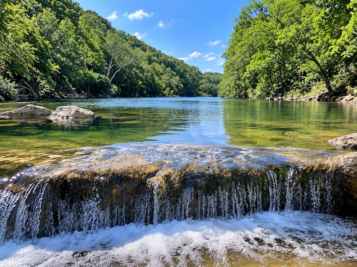
The City publishes three cautions, and each has a mechanism behind it.
- Water can rise quickly, even when it is dry where you are. Rain upstream reaches the corridor on its own schedule. Never cross fast or rising water, and check the gauge and forecast before you go. The National Weather Service’s Turn Around Don’t Drown guidance notes that six inches of fast-moving flood water can knock over an adult. If you are traveling the region by RV, see our notes on planning around Central Texas storms for the same caution at your campsite.
- There is little to no lighting. Carry a flashlight, headlamp, or safety light if there is any chance you will still be out near sunset.
- Heat on exposed limestone is real. Central Texas sun bounces off pale rock, and the City lists no drinking water at trailheads. Carry more water than you think you need.
Before choosing a start time, check three things: water, weather, and sunset.
Best Time to Visit by Season
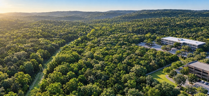
Spring and fall can bring milder hiking weather. Summer means preparing for heat. In every season, check conditions before you leave, because water depends on recent rainfall and local conditions rather than the calendar. If the creek is low when you plan to swim, our guide to Hill Country state and national parks covers other outdoor options west of Austin.
Who the Greenbelt Suits, and Who Should Plan Differently
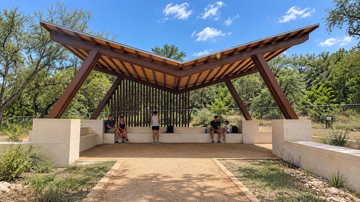
The Greenbelt’s interior trails are rough and uneven. At the Zilker entrance, the City’s Mile Zero project added improved crosswalks and ADA access, a stabilized decomposed-granite trail, and an observation deck and overlook, described on the City’s Violet Crown Trail page. Those entrance improvements do not create an accessible route through the Greenbelt or to its swimming holes.
- Wheelchair users and people with limited mobility. Plan around the interior terrain and contact Austin Parks and Recreation to confirm the specific route you need.
- Families with standard strollers. The improved surface is at the entrance only, so plan for the interior trail without the stroller.
- Families with young kids. Shorter out-and-backs, water shoes, and a firm turn-around point make for a better day.
- Dog owners. The six-foot leash and the algae precautions both apply.
- Visitors without a car. Confirm transportation to and from your chosen trailhead before you leave, including your return trip before dark.
How the Greenbelt Came to Be
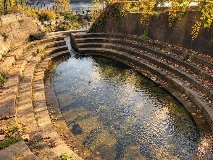
Barton Springs, the spring-fed landmark at the Greenbelt’s mile 0 end, takes its name from William Barton, an early settler, according to the Texas State Historical Association.
The corridor itself was assembled in stages. A 1999 City Parks and Recreation Department memorandum to the Parks and Recreation Board lays out the record:
- Before 1980. The City had acquired the Greenbelt between Zilker Park and Loop 360.
- 1980 and 1981. The City acquired 377 acres between Loop 360 and Lost Creek.
- The trail, a parking lot, trail entries, composting toilets, and signs were completed with grant assistance from Texas Parks and Wildlife. The Camp Craft trailhead was built that year but kept closed at the Woods of Westlake neighborhood’s request.
- The City Council approved opening the Camp Craft trailhead in June.
Separately, the Trust for Public Land reports purchasing nearly 1,000 acres in the Barton Creek watershed between 1992 and 1999.
Today the City records about 810 acres for the Greenbelt and, as a separate entry, about 1,128 acres for Barton Creek Wilderness Park. Those are different records, not measurements of the same acquisitions.
The newest chapter starts at mile 0. The Violet Crown Trail, developed by the City with the Hill Country Conservancy and planned at 30 miles, begins at the Greenbelt’s Zilker entrance, and its Mile Zero Trailhead opened in fall 2025.
Visiting the Greenbelt From the Hill Country
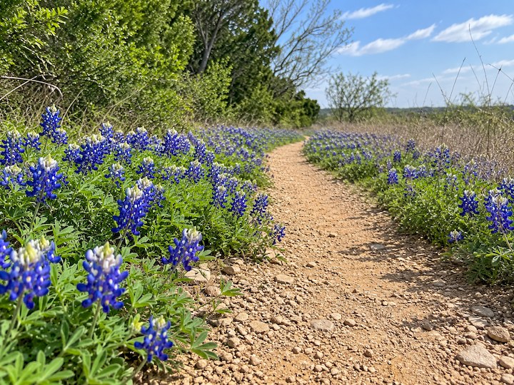
The Greenbelt is a day-use destination, not an RV campground. Do not camp there or plan an overnight stay in a trailhead lot, since facilities close at 10 p.m. The City’s access point listing does not specify RV or trailer accommodation, so a passenger vehicle, tow vehicle, or second car is the simpler way in. Check lot and street signs before you park.
Whether you live ten minutes away or are driving in from the Hill Country for the day, the same planning applies: pick the access point, check the gauge, then go.
For a longer stay, Miller Creek RV Park is an RV park west of Austin, about an hour out on U.S. 281 between Johnson City and Blanco. We offer full-hookup RV sites with 20/30/50 amp service, and log cabins for travelers without a rig. Our own Austin page names the Greenbelt as one of the city’s outdoor escapes. When the creek is low, the Blanco State Park guide covers a river closer to the park, and our attractions page lists more within a drive.
Quick Answers
Is the Barton Creek Greenbelt free?
The City lists no entry fee. Parking is free at several trailheads, while the Zilker lot charges on weekends and holidays in season, and Camp Craft Road has paid street parking.
What are the Greenbelt hours?
City parks are generally open 5 a.m. to 10 p.m. unless otherwise posted, and all facilities close at 10 p.m. under City ordinance. There is little to no lighting.
Where can you park for the Greenbelt?
The City lists free lots at the 360 trailhead and at Barton Hills School Park on Homedale Drive, free street parking at Gus Fruh and Gaines Park/MoPac, street parking at Spyglass, paid street parking at Camp Craft Road, and a seasonal paid lot at Zilker. Confirm current terms with the City before you go.
How long is the Barton Creek Greenbelt trail?
The City describes a main trail of about 7.5 miles and more than 12 miles to explore across the Greenbelt. Use the official trailhead map to plan your specific route.
How can you check water levels on the Greenbelt?
Use the USGS “Barton Creek at Loop 360” gauge (site 08155300) or LCRA Hydromet and look at the recent trend in discharge or gage height. The gauge describes one location, does not test water safety, and cannot tell you the depth of any pool.
Is it safe to swim in Barton Creek?
The pools are natural, with no lifeguards. The City advises staying out if there has been rain in the past three days or if the water is warm, stagnant, or shows scum, film, or algae, and to rinse skin and pet fur after contact.
Which access point is closest to Twin Falls?
The City lists the Gaines Park/MoPac Trailhead at 3918 South MoPac Expressway southbound service road as the access point for Twin Falls.
Where do you start for the Hill of Life?
The City lists the Trail’s End/Camp Craft Road Trailhead at 1712 Camp Craft Road as the access point for the Hill of Life.
Are dogs allowed on the Greenbelt?
Yes, on a leash no longer than six feet. There are no off-leash areas on the Greenbelt, and pet waste must be carried out.
Can you camp at the Greenbelt?
No. Camping is not allowed on the Greenbelt under City guidance citing City Code 9-4-11.
Can you bring glass bottles to the Greenbelt?
No. City parks policy prohibits glass containers in all City parks, along with Styrofoam and smoking.
Is alcohol allowed on the Greenbelt?
No. City Code 8-3-1 prohibits possessing or consuming alcohol in public recreation areas unless code provides otherwise.
A Creek That Rewards Checking First
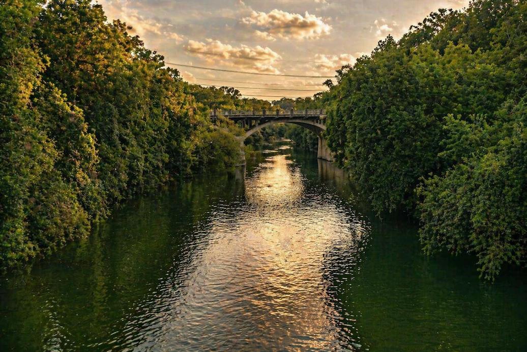
Pick the access point that matches the day you want, check the gauge and the forecast, and the Greenbelt delivers. Skip either step and the day can end at a full lot or a dry creek bed.
If you are looking for a base in the Hill Country for Austin day trips, Miller Creek RV Park sits on U.S. 281 between Johnson City and Blanco, with full-hookup RV sites and log cabins for travelers without a rig. Call us at (830) 868-2655 or check availability and book your stay.